Weather Warning
IDN21037
Australian Government Bureau of Meteorology
New South Wales
Severe Weather Warning
Issued at 4:21 PM EDT on Saturday 28 Feb 2026.
Weather Situation
Heavy rainfall developing about the far southwest this afternoon.
Weather Situation: Tropical humidity on the southeastern flank of a low in central Australia is expected to increase today leading to the development of a broad region of rain with embedded thunderstorms. Rain rates may ease for a period during the day on Sunday, before increasing overnight into Monday with the approach of a cold front.
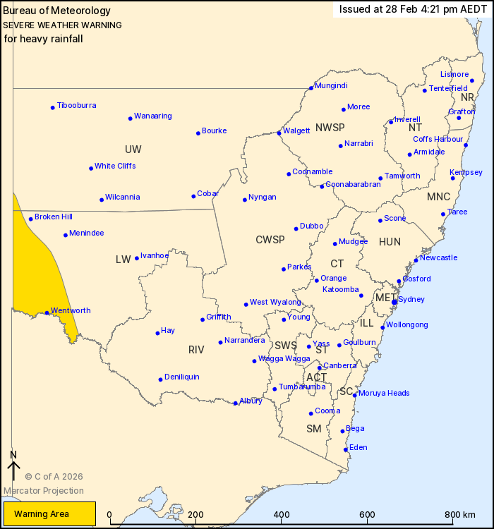
HEAVY RAINFALL which may lead to FLASH FLOODING is forecast for the far southwestern parts of the Lower Western and Upper Western forecast districts from this afternoon and overnight tonight, however is more likely from Sunday evening. Six-hourly rainfall totals between 40 to 60 mm are possible.
Locations which may be affected include Wentworth.
Flood Watches and Warnings are current for the area. Please refer to https://www.bom.gov.au/weather-and-climate/warnings-and-alerts/ for more information.
The State Emergency Service advises that people should:
- * Don't drive, ride or walk through flood water.
- * Keep clear of creeks and storm drains.
- * If you are trapped by flash flooding, seek refuge in the highest available place and ring 000 if you need rescue.
- For emergency help in flood and storms, ring the SES on 132 500.
- Stay updated on the Hazards Near Me NSW app or the ACT ESA website (https://esa.act.gov.au).
Check https://www.bom.gov.au/weather-and-climate/warnings-and-alerts. Warnings are also available through TV and Radio broadcasts or call 1300 659 210. The Bureau and State Emergency Service would appreciate warnings being broadcast regularly.